Florida Map
|
 |
 |
Where Is Florida?
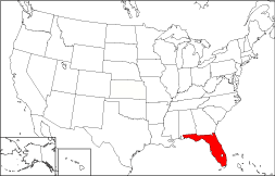
Florida's location is highlighted in red on the map to the right. The State of Florida is bounded by Georgia on the north, by the Straits of Florida on the south, and by the Atlantic Ocean on the east. It is bounded by Alabama on the northwest, and by the Gulf of Mexico on the southwest.
Florida Maps
Florida is the 26th largest state in the United States, covering a land area of 53,927 square miles (139,671 square kilometers). There are 67 counties in the state. This Florida map site features road maps, topographical maps, and relief maps of Florida. The detailed, scrollable road map displays Florida counties, cities, and towns as well as Interstate, U.S., and Florida state highways. The pannable, scalable Florida street map can be zoomed in to show local streets and detailed imagery.
Florida Highway Map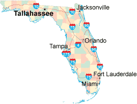 Click on the highway map thumbnail
to view a scalable Florida road map. |
FL Topo Map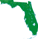 Click map to enlarge.
|
FL Relief Map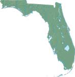 Click map to enlarge.
|
The detailed Florida map and the regional Florida map display cities, roads, rivers, and lakes as well as terrain features. The detailed map shows only the State of Florida, while the regional map shows Florida and the surrounding region.
Florida Infrastructure > Florida Airports
Much of Florida's income derives from tourism, but there is a major industrial area along the northeastern coast, around Cape Canaveral's Kennedy Space Center. In 2005, the population of Florida was estimated at 17,768,191, which is about 329.9 people per square mile. In 2010, Florida's population rose to 18,801,310 people. More recently, in the 2020 census, the Florida population was 21,538,187. Florida's Interstate Highways include I-4, I-10, I-75, and I-95.
Florida Topography and Tourist Attractions
 Florida was named in honor of Pascua florida, the Spanish Easter
celebration, which means "feast of the flowers".
Much of Florida is located on the Florida peninsula with its thousands of
lakes, meandering rivers, and vast wetland areas. Lake Okeechobee,
the largest lake in southern USA, feeds the 40-mile wide Everglades marsh
area, home to many rare flora and fauna species. A chain of small
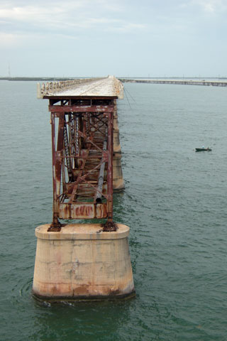
coral islands, known as the Florida Keys, stretches southwest toward the
Gulf of Mexico from Florida's southern tip. These islands comprise
North America's largest coral reef system. The Florida Keys, along
with the Everglades National Park and the Walt Disney World theme park in
Orlando, are the state's leading tourist attractions.
Florida was named in honor of Pascua florida, the Spanish Easter
celebration, which means "feast of the flowers".
Much of Florida is located on the Florida peninsula with its thousands of
lakes, meandering rivers, and vast wetland areas. Lake Okeechobee,
the largest lake in southern USA, feeds the 40-mile wide Everglades marsh
area, home to many rare flora and fauna species. A chain of small
coral islands, known as the Florida Keys, stretches southwest toward the
Gulf of Mexico from Florida's southern tip. These islands comprise
North America's largest coral reef system. The Florida Keys, along
with the Everglades National Park and the Walt Disney World theme park in
Orlando, are the state's leading tourist attractions.
For additional Florida travel and tourism information, visit the official Florida tourism site and Florida Atlas.
Other Florida Maps
This online Florida reference map shows major cities, roads, railroads, and physical features in Florida.Several map publishing companies offer printed maps of Florida. For example, Omni Resources offers several maps of Florida that feature points of interest, airports, and parks, as well as selected local attractions and insets of major Florida cities.
All rights reserved.
Certain maps hereon are © Map Resources or Digital Wisdom.
To facilitate browsing, certain external links will open in new windows.
Florida-Map.org Editor, State Maps, PO Box 828, Barnegat, NJ 08005.